
 Continue with onX Maps
 Continue with Facebook


 Particularly Special Place


 Easy/Intermediate


 Easy/Intermediate
Land Manager: Parks Canada - Kootenay National Park
 Rockwall
34.2 mi 55.1 km • 8,254' Up 2515.76 m Up • 7,935' Down 2418.59 m Down
Banff, AB
 Healy Pass Out and Back
11.6 mi 18.6 km • 2,181' Up 664.7 m Up • 2,181' Down 664.68 m Down
Banff, AB
Cory & Edith Passes
8.1 mi 13.0 km • 3,312' Up 1009.57 m Up • 3,314' Down 1010.24 m Down
Banff, AB
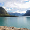
 Lake Minnewanka: Warden's Cabin Out-and-Back
19.1 mi 30.7 km • 62' Up 18.98 m Up • 62' Down 18.84 m Down


0 Comments