
Land Manager: East Bay Regional Park District (CA)
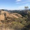
 Briones-Alhambra Valley Loop
4.4 mi 7.1 km • 760' Up 231.56 m Up • 761' Down 232.01 m Down
 Rim Trail
5.2 mi 8.3 km • 903' Up 275.09 m Up • 901' Down 274.55 m Down
 Lafayette, CA
 Las Trampas North Loop
9.6 mi 15.4 km • 2,273' Up 692.77 m Up • 2,300' Down 701.16 m Down
Stage Road Loop
4.1 mi 6.6 km • 590' Up 179.73 m Up • 585' Down 178.34 m Down
 Mt. Diablo Summit Loop - South
16.0 mi 25.8 km • 3,679' Up 1121.47 m Up • 3,678' Down 1121.12 m Down
Diablo, CA
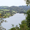
Briones Reservoir Loop Trail
13.4 mi 21.6 km • 1,081' Up 329.57 m Up • 1,087' Down 331.3 m Down

 Continue with onX Maps
 Continue with Facebook


 Particularly Special Place


0 Comments