
 Continue with onX Maps
 Continue with Facebook


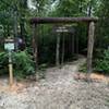
 Particularly Special Place


 Difficult
Difficult
Difficult
 Difficult
 Race - Apr 18, 2020
Land Manager: Buncombe County, NC
 Graybeard/Harry Bryan/Julia Woodward Loop
1.3 mi 2.1 km • 275' Up 83.9 m Up • 277' Down 84.46 m Down

 Hellbender 100 Mile
103.4 mi 166.4 km • 21,295' Up 6490.7 m Up • 21,305' Down 6493.66 m Down
Black M…, NC
Gateway Trails
7.5 mi 12.0 km • 942' Up 287.01 m Up • 941' Down 286.84 m Down
Rattlesnake Lodge Loop
4.0 mi 6.5 km • 847' Up 258.17 m Up • 847' Down 258.18 m Down
 Mount Mitchell
11.7 mi 18.8 km • 3,651' Up 1112.72 m Up • 3,650' Down 1112.62 m Down
 Black M…, NC
Quest For The Crest 10K
Black M…, NC
Quest For The Crest 10K
6.9 mi 11.2 km • 3,025' Up 922.17 m Up • 3,025' Down 921.9 m Down
Burnsville, NC


 All Clear


0 Comments