
 Continue with onX Maps
 Continue with Facebook


 Particularly Special Place


 Intermediate


 Intermediate
 TransRockies Stage 1 Reroute 2021
20.2 mi 32.6 km • 2,191' Up 667.93 m Up • 2,194' Down 668.66 m Down
TransRockies Day 1 Buena Vista Colorado (Old Stage 1)
22.2 mi 35.7 km • 2,530' Up 771.22 m Up • 2,200' Down 670.67 m Down
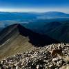
 Mt. Princeton
7.2 mi 11.7 km • 3,236' Up 986.28 m Up • 3,235' Down 985.89 m Down
Breakfast Meats Loop
6.4 mi 10.3 km • 495' Up 150.94 m Up • 494' Down 150.51 m Down
Buena V…, CO
 High Lonesome 100 Mile Trail Race
102.0 mi 164.2 km • 21,057' Up 6418.14 m Up • 21,057' Down 6418.27 m Down
Alpine, CO
Missouri Mountain
10.9 mi 17.5 km • 4,399' Up 1340.95 m Up • 4,400' Down 1340.98 m Down


0 Comments