
 Continue with onX Maps
 Continue with Facebook


 Particularly Special Place


 Intermediate/Difficult
Intermediate/Difficult
Intermediate/Difficult
 Intermediate/Difficult
Land Manager: USFS - Gallatin National Forest Office
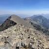
 Sacagawea Peak
4.2 mi 6.8 km • 1,794' Up 546.91 m Up • 1,793' Down 546.43 m Down

 Bozeman, MT
 North Cottonwood Loop
3.6 mi 5.9 km • 872' Up 265.81 m Up • 871' Down 265.5 m Down
Bridger Ridge Traverse 2.0 (M to Corbly)
25.9 mi 41.6 km • 8,533' Up 2600.99 m Up • 8,128' Down 2477.29 m Down
Bozeman, MT
 Bozeman "M" Out-and-Back
1.9 mi 3.1 km • 811' Up 247.05 m Up • 810' Down 246.89 m Down
Triple Tree Trail
5.6 mi 9.1 km • 906' Up 276.15 m Up • 906' Down 276.15 m Down
Bozeman, MT
Mt. Ellis
10.8 mi 17.3 km • 3,573' Up 1089.2 m Up • 3,573' Down 1089.07 m Down


0 Comments