Continue with onX Maps
 Continue with Facebook


 Particularly Special Place


Orem and Provo
 UT
UT- Salt Lake City and Wasatch Front
- Orem and Provo


Recommended Routes in Orem and Provo - 4
Trail Run Project is built by runners like you. Add Your Recommended Routes


 Difficult
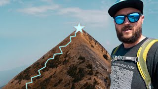
Squaw Peak 50 Mile Trail Run
52.0 mi 83.6 km • 9,406' Up 2866.94 m Up • 9,400' Down 2865.19 m Down
 Lindon, UT

 Intermediate/Difficult
The "Y" Mountain Peak
6.7 mi 10.7 km • 3,308' Up 1008.2 m Up • 3,307' Down 1008.07 m Down


Orem and Provo Running
- 37 Miles 60 Kilometers of Trail
- 4 Recommended Routes
- 1
Easy Trail

- 11
Intermediate Trails

- 8
Difficult Trails

Trail Run Project is built by runners like you. Share
what you know about this area!
Areas Within Orem and Provo
Weather Averages
|
High
|
Low
|
Precip
|
Days w/
|
| J | F | M | A | M | J | J | A | S | O | N | D |
Trails in Orem and Provo - 16
Trail Run Project is built by runners like you. Add Your Trails
|
2.1
mi
3.4
km
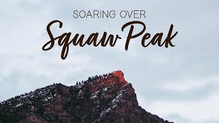
#1Squaw Peak Trail
Intermediate/Difficult
Provo, UT
|
Intermediate/Difficult
|
Provo, UT |
21
|
|
|
4.0
mi
6.4
km
#2Cascade Saddle Trail
Intermediate/Difficult
Orem, UT
|
Intermediate/Difficult
|
Orem, UT |
3
|
|
2.9
mi
4.6
km
#3Rock Canyon Trail
 Intermediate
Provo, UT
|
Intermediate
|
Provo, UT |
11
|
|
|
0.9
mi
1.5
km
#4Provo Peak Trail
Difficult
Provo, UT
|
Difficult
|
Provo, UT |
4
|
|
|
5.4
mi
8.7
km
#5BST: Provo Canyon
Intermediate/Difficult
Orem, UT
|
Intermediate/Difficult
|
Orem, UT |
3
|
|
|
2.0
mi
3.2
km
#6Rock Canyon First Right Fork Trail
Intermediate/Difficult
Provo, UT
|
Intermediate/Difficult
|
Provo, UT |
2
|
|
|
1.5
mi
2.4
km
#7BST: Highline
Intermediate
Springville, UT
|
Intermediate
|
Springville, UT |
2
|
|
|
1.6
mi
2.6
km
#8Powerhouse Mountain FS Road #70759
Intermediate
Springville, UT
|
Intermediate
|
Springville, UT |
1
|
|
|
3.7
mi
6.0
km
#9Slate Canyon Trail #061
Intermediate/Difficult
Provo, UT
|
Intermediate/Difficult
|
Provo, UT |
3
|
|
|
1.5
mi
2.4
km
#10Kyhv Peak Overlook Trail
Difficult
Orem, UT
|
Difficult
|
Orem, UT |
2
|
Photos of Orem and Provo - 29
Trail Run Project is built by runners like you. Add Your Photos