
 Continue with onX Maps
 Continue with Facebook


 Particularly Special Place


 Intermediate/Difficult

 Intermediate/Difficult
Land Manager: Camp Merrowvista
 Devil's Den Mountain
4.1 mi 6.6 km • 461' Up 140.43 m Up • 460' Down 140.22 m Down

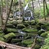
 Mt. Chocorua - Champney Falls Route
7.2 mi 11.5 km • 2,162' Up 659.05 m Up • 2,163' Down 659.27 m Down
Ferncroft, NH
 Walter - Newton Loop
1.5 mi 2.5 km • 158' Up 48.3 m Up • 156' Down 47.69 m Down
Mt. Prospect
3.3 mi 5.4 km • 972' Up 296.22 m Up • 970' Down 295.76 m Down
Plymouth, NH
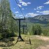
Snow's Mountain Lower Loop
3.4 mi 5.4 km • 807' Up 246.04 m Up • 804' Down 244.94 m Down
Mount Osceola Out and Back
5.9 mi 9.4 km • 1,952' Up 595.09 m Up • 1,952' Down 595.07 m Down


0 Comments