
 Continue with onX Maps
 Continue with Facebook


 Particularly Special Place


 Intermediate/Difficult
Intermediate/Difficult
Intermediate/Difficult
 Intermediate/Difficult
Land Manager: USFS - Wallowa-Whitman National Forest Office
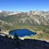
 Blue Lake Loop
19.2 mi 31.0 km • 3,562' Up 1085.71 m Up • 3,561' Down 1085.35 m Down

 Joseph, OR
 Eagle Cap Wilderness Loop
40.3 mi 64.8 km • 10,001' Up 3048.17 m Up • 10,003' Down 3048.81 m Down
Joseph, OR
Southern High Lakes Tour Loop
59.4 mi 95.6 km • 14,593' Up 4448.04 m Up • 14,591' Down 4447.43 m Down
Union, OR


0 Comments