
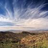
Land Manager: NPS - Saguaro National Park
 Wasson Peak Summit
9.4 mi 15.1 km • 2,113' Up 644.1 m Up • 2,113' Down 644.01 m Down

 Flowing…, AZ
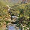
Wasson Peak Circle Route
Flowing…, AZ
Wasson Peak Circle Route
8.4 mi 13.5 km • 1,905' Up 580.66 m Up • 1,912' Down 582.77 m Down
Tucson…, AZ
 Mount Kimball Out-and-Back
8.7 mi 14.0 km • 4,125' Up 1257.22 m Up • 4,124' Down 1256.97 m Down
Catalin…, AZ
Bear Canyon Loop
16.9 mi 27.2 km • 2,465' Up 751.48 m Up • 2,456' Down 748.6 m Down
Catalin…, AZ
 Honeybee Canyon Loop
22.3 mi 35.9 km • 964' Up 293.83 m Up • 964' Down 293.83 m Down
Catalina, AZ
Marshall Gulch To Aspen Loop
3.8 mi 6.1 km • 814' Up 248.11 m Up • 831' Down 253.3 m Down
Tanque…, AZ

 Continue with onX Maps
 Continue with Facebook


 Particularly Special Place


 All Clear


0 Comments