
 Continue with onX Maps
 Continue with Facebook


 Particularly Special Place


 Easy
Easy
Easy
Easy
 Easy
Easy
Land Manager: Dead Horse Point State Park
 Funnel Arch Hike
0.5 mi 0.9 km • 223' Up 68.08 m Up • 227' Down 69.24 m Down

 Moab Retreat: Day 2 Half Pint
16.1 mi 26.0 km • 1,407' Up 428.76 m Up • 1,407' Down 428.8 m Down
Moab, UT
Longbow Arch Trail (Longview Arch)
2.2 mi 3.5 km • 362' Up 110.3 m Up • 361' Down 110.13 m Down
Moab, UT
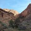
Amasa Back/Jackson's Loop
6.7 mi 10.8 km • 989' Up 301.46 m Up • 990' Down 301.89 m Down
 Moab, UT
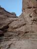
Moonflower Canyon
Moab, UT
Moonflower Canyon
0.6 mi 1.0 km • 66' Up 20.04 m Up • 66' Down 19.98 m Down
Moab, UT
 Upheaval Dome Overlook Trail
1.4 mi 2.3 km • 278' Up 84.69 m Up • 278' Down 84.7 m Down


0 Comments