
 Continue with onX Maps
 Continue with Facebook


 Particularly Special Place


 Intermediate
Intermediate
Intermediate
 Intermediate
Land Manager: Monterey County - Parks
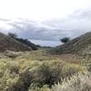
 Snively's Ridge Out-and-Back
5.8 mi 9.4 km • 1,500' Up 457.33 m Up • 1,497' Down 456.4 m Down

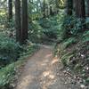
 Soberanes Canyon Loop
4.7 mi 7.6 km • 1,752' Up 533.86 m Up • 1,751' Down 533.82 m Down
 Carmel-…, CA
Big Sur Trail Marathon
Carmel-…, CA
Big Sur Trail Marathon
26.2 mi 42.1 km • 5,576' Up 1699.55 m Up • 5,575' Down 1699.13 m Down
Carmel…, CA
Molera Beach Super Loop
7.0 mi 11.3 km • 1,142' Up 348.01 m Up • 1,143' Down 348.3 m Down
Carmel…, CA
 Merry-Go-Round to Sprig Trail Loop
8.8 mi 14.2 km • 1,676' Up 510.98 m Up • 1,678' Down 511.54 m Down
Gilroy, CA
Merry-Go-Round Loop
4.1 mi 6.6 km • 826' Up 251.67 m Up • 826' Down 251.7 m Down
Gilroy, CA


0 Comments