
 Continue with onX Maps
 Continue with Facebook


 Particularly Special Place


 Intermediate
Intermediate
Intermediate
 Intermediate
 LiveBIG Family Adventure Run
1.3 mi 2.2 km • 154' Up 46.98 m Up • 165' Down 50.44 m Down
 Ridgeline Trail 50K
32.5 mi 52.2 km • 3,021' Up 920.83 m Up • 3,032' Down 924.07 m Down
Greenland Trail 25K
15.5 mi 25.0 km • 900' Up 274.19 m Up • 898' Down 273.61 m Down
Greenland Trail 8M
8.2 mi 13.3 km • 456' Up 139 m Up • 453' Down 138.13 m Down
 Harrison Crash Site via Ice Cave
11.1 mi 17.8 km • 2,066' Up 629.6 m Up • 2,065' Down 629.51 m Down
Palmer…, CO
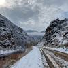
 Waterton Canyon
13.9 mi 22.3 km • 579' Up 176.61 m Up • 579' Down 176.62 m Down


0 Comments