Dogs Unknown

Features
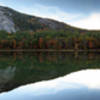
Views · Wildlife

This trail is for winter use only when snow covered.
Description
This trail starts in a parking area off 171, in Castle in the Clouds Conservation Area. There are no shelters along the way and no camping along the trail, so make sure you're prepared to take on the whole trail at once. Staging cars at the beginning and end might be a good idea.
The trail starts in the southeast corner of the parking lot and heads north across 171. The trail coincides with the Shannon Brook (running) Trail for a ways. The trail switches to coincide with the
Turtleback Mountain Trail. The trail continues to steadily climb over multiple switchbacks to
Turtleback Mountain Summit Trail. From here, the trail keeps on climbing to the Black Snout Trail (on right). The trail continues to follow the
Turtleback Mountain Trail until it reaches the High
Ridge Trail and follows it right. The trail coincides with the High
Ridge Trail until it splits at the Shaw Trail. The Shaw Trail splits here and runs to the summit of Mount Shaw. I've heard that the views from the top are spectacular, though I didn't have time to make it to the top.
Corridor 15 runs downhill with a few restricted views along the way. The trail is pretty straightforward from here on out... and pretty boring. From Shaw Trail, there's about 10 miles of mundane running to the trail's end in West Ossipee.
At Route 25, the trail veers right and parallels the highway. Shortly after the bridge, the trail veers right again into the woods. This section of trail is sometimes closed due to flooding. The trail crosses over Route 16/25, goes through a field, and ends at the railroad tracks (Corridor 19).
Contacts
Shared By:
David Smith

 Continue with onX Maps
 Continue with Facebook


 Particularly Special Place


 Intermediate


0 Comments