
 Continue with onX Maps
 Continue with Facebook


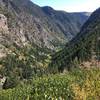
 Particularly Special Place


 Intermediate

 Intermediate
Land Manager: BLM Colorado - Colorado River Valley Field Office
 Mount Sopris
13.4 mi 21.5 km • 4,228' Up 1288.82 m Up • 4,228' Down 1288.66 m Down
El Jebel, CO
 Capitol Creek
12.5 mi 20.2 km • 2,295' Up 699.44 m Up • 2,293' Down 698.86 m Down
 Snowmas…, CO
Capitol Lake, Avalanche Creek, Hell's Roaring Pass Loop
Snowmas…, CO
Capitol Lake, Avalanche Creek, Hell's Roaring Pass Loop
24.6 mi 39.6 km • 6,491' Up 1978.41 m Up • 6,420' Down 1956.74 m Down
 Capitol Peak
16.0 mi 25.8 km • 5,337' Up 1626.58 m Up • 5,339' Down 1627.3 m Down
Snowmas…, CO
Avalanche Creek Trail
21.3 mi 34.4 km • 3,834' Up 1168.72 m Up • 3,834' Down 1168.75 m Down
Grizzly to No Name (Jess Weaver) Loop
11.5 mi 18.5 km • 2,823' Up 860.47 m Up • 2,813' Down 857.46 m Down


0 Comments