
 Continue with onX Maps
 Continue with Facebook


 Particularly Special Place


 Intermediate
Intermediate
Intermediate
 Intermediate
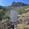
Land Manager: U.S. Army - Fort Huachuca
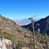
 Carr Peak via Miller Canyon Trail
10.3 mi 16.5 km • 3,488' Up 1063.26 m Up • 3,488' Down 1063.16 m Down

 Sierra…, AZ
 Clark Spring Trail #124 Out-and-Back
3.7 mi 5.9 km • 505' Up 153.91 m Up • 505' Down 153.81 m Down
Miller Peak from Montezuma's Pass
9.9 mi 15.9 km • 2,910' Up 886.97 m Up • 2,910' Down 886.92 m Down
Sierra…, AZ
Old Pueblo 50 Course
26.3 mi 42.3 km • 3,295' Up 1004.44 m Up • 3,307' Down 1008.05 m Down
Corona…, AZ
 Florida Canyon Trail #145
8.8 mi 14.1 km • 3,466' Up 1056.56 m Up • 3,466' Down 1056.36 m Down
Colossal Vail 50/50
54.6 mi 87.9 km • 4,002' Up 1219.7 m Up • 4,000' Down 1219.08 m Down


0 Comments