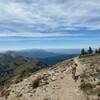
Land Manager: USFS - Bridger Teton National Forest Office
 Cache Creek to Skyline Loop
13.7 mi 22.0 km • 1,936' Up 590.13 m Up • 1,936' Down 590.19 m Down


 Jackson, WY
 Rendezvous Mountain Hillclimb
6.1 mi 9.8 km • 4,104' Up 1250.84 m Up • 51' Down 15.5 m Down


 Moose W…, WY
 Granite Canyon - Tram Route
13.4 mi 21.5 km • 554' Up 168.86 m Up • 4,646' Down 1415.95 m Down


 Moose W…, WY
 Jackson Peak
5.1 mi 8.2 km • 2,567' Up 782.29 m Up • 0' Down 0 m Down


 Jackson, WY
 Upper Palisades Lake
14.4 mi 23.1 km • 1,726' Up 526.16 m Up • 1,726' Down 526.21 m Down


 Irwin, ID
 Bradley - Taggart
6.2 mi 9.9 km • 656' Up 199.81 m Up • 660' Down 201.26 m Down


 Jackson, WY


0 Comments