
 Continue with onX Maps
 Continue with Facebook


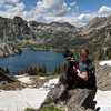
 Particularly Special Place


 Difficult

 Difficult
 Zirkel Circle
10.4 mi 16.8 km • 2,360' Up 719.41 m Up • 2,363' Down 720.25 m Down
Steambo…, CO
 Hahns Peak Trail #1158
3.8 mi 6.1 km • 1,382' Up 421.33 m Up • 1,379' Down 420.36 m Down
 Steambo…, CO
2018 Continental Divide Trail Run
Steambo…, CO
2018 Continental Divide Trail Run
31.4 mi 50.5 km • 4,606' Up 1403.99 m Up • 2,987' Down 910.33 m Down
Steambo…, CO
 Emerald Mountain Epic-10K
6.4 mi 10.3 km • 910' Up 277.27 m Up • 907' Down 276.39 m Down
Steambo…, CO
Emerald Mountain Epic-Half Marathon
13.6 mi 21.9 km • 1,620' Up 493.69 m Up • 1,616' Down 492.48 m Down
Steambo…, CO
Thunderhead Trail
4.1 mi 6.5 km • 2,110' Up 643.25 m Up • 0' Down 0 m Down
Steambo…, CO


0 Comments