
 Continue with onX Maps
 Continue with Facebook


 Particularly Special Place


 Easy
Easy
Easy
Easy
 Easy
Easy
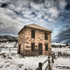
Land Manager: City of Westminster - Parks and Recreation
 South Mesa Loop
3.1 mi 5.0 km • 508' Up 154.7 m Up • 507' Down 154.43 m Down

 South Table Figure 8
7.1 mi 11.4 km • 609' Up 185.5 m Up • 608' Down 185.46 m Down
 Shorthorn - Longhorn Loop
6.8 mi 11.0 km • 1,175' Up 358.06 m Up • 1,177' Down 358.64 m Down
North Table Mountain - Short Loop
3.3 mi 5.3 km • 520' Up 158.58 m Up • 525' Down 159.98 m Down
 Golden Cliffs Loop
1.6 mi 2.6 km • 529' Up 161.36 m Up • 536' Down 163.41 m Down
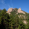
Golden, CO
Shanahan Ridge
3.9 mi 6.3 km • 831' Up 253.22 m Up • 831' Down 253.4 m Down


0 Comments