
 Continue with onX Maps
 Continue with Facebook


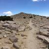
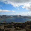
 Particularly Special Place


 Difficult
Difficult
Difficult
 Difficult
Land Manager: USFS - San Bernardino National Forest Office
 Big Bear - Champion Lodgepole Pine & Bluff Lake
0.5 mi 0.9 km • 3' Up 1.04 m Up • 97' Down 29.61 m Down

 South Fork of the Santa Ana River via Dollar Lake
19.7 mi 31.8 km • 4,569' Up 1392.64 m Up • 4,568' Down 1392.44 m Down
Big Bea…, CA
 San Bernadino Peak via Angelus Oak
16.3 mi 26.2 km • 4,609' Up 1404.77 m Up • 4,632' Down 1411.9 m Down
 Big Bea…, CA
Keller Peak via Exploration Trail
Big Bea…, CA
Keller Peak via Exploration Trail
12.6 mi 20.3 km • 2,022' Up 616.43 m Up • 2,022' Down 616.43 m Down
Running…, CA
San Gorgonio Peak
16.3 mi 26.3 km • 5,484' Up 1671.53 m Up • 5,484' Down 1671.41 m Down
Banning, CA
Terri Peak Summit
4.0 mi 6.5 km • 867' Up 264.33 m Up • 867' Down 264.31 m Down


0 Comments