Trail Run Project Logo

A section of the descent from Takanosu with views and forests.


Your Rating: Rating Rating Rating Rating Rating      Clear Rating
Your Difficulty:
Your Favorites: Add To-Do · Your List
Zoom in to see details
Map Key

1.6

Miles

2.5

KM

72%

Runnable

5,587' 1,703 m

High

4,678' 1,426 m

Low

0' 0 m

Up

910' 277 m

Down

11%

Avg Grade (6°)

37%

Max Grade (20°)

Dogs Unknown

Runner Notes

We did see a few trail runners on this section of the trail. This particular section is not very steep, but the trails north of Takanosa and the bottom of this trail to Hara is slightly steep.

Description

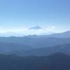
After summiting Mt. Takanosa, one option for descending is going south from Mt. Takanosu to Kayanokiyama. This part of the descent is only about 1.5 miles. While still near the top, you'll still have some views of Mt. Fuji to your right. Eventually you'll enter tree cover.

About half a mile from the summit, you'll reach an intersection. You'll have the choice of heading east towards Mutsuishiyama and running straight to Okutama. This is the longer running distance option. Alternatively, stay heading south towards Kayanokiyama, continuing on the Kuratosan Trail and eventually ending in Hara to take the bus back to Okutama (if that is your destination).

Flora & Fauna

You might see some monkeys.

Shared By:

Dylan Pradas

Trail Ratings

  3.5 from 2 votes

#2

in Kayanokiyama

#25979

Overall
  3.5 from 2 votes
5 Star
0%
4 Star
50%
3 Star
50%
2 Star
0%
1 Star
0%
Trail Rankings

#2

in Kayanokiyama

#37

in Japan

#25,979

Overall
2 Views Last Month
179 Since Dec 19, 2016
Intermediate Intermediate

0%
0%
100%
0%
0%
0%

Photos

View of Mt Fuji from Takanosu Summit
Dec 1, 2016 near Chichibu, JP

0 Comments

Current Trail Conditions

Unknown
Add Your Check-In

Check-Ins

none
Welcome

Join the Community

Create your FREE account today!
Already have an account? Login to close this notice.

Get Started