
 Continue with onX Maps
 Continue with Facebook


 Particularly Special Place


 Intermediate
Intermediate
Intermediate
 Intermediate
Land Manager: Midpeninsula Regional Open Space
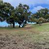
 Vista Verde Skyline Run - 10K
6.5 mi 10.5 km • 1,116' Up 340.12 m Up • 1,116' Down 340.24 m Down
 La Honda, CA
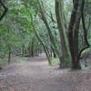
 Los Trancos Loop
7.2 mi 11.5 km • 1,545' Up 470.96 m Up • 1,541' Down 469.74 m Down
Ladera, CA
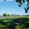
Creek/Pipeline loop at Hidden Villa
1.2 mi 1.9 km • 172' Up 52.34 m Up • 172' Down 52.3 m Down
Los Alt…, CA
 Arastradero Short Loop
3.4 mi 5.5 km • 421' Up 128.26 m Up • 417' Down 127.03 m Down
Heritage Grove Loop with Extension & Overlook
8.0 mi 12.8 km • 1,387' Up 422.68 m Up • 1,388' Down 423.06 m Down
Rancho Ridge Loop
13.6 mi 21.9 km • 2,279' Up 694.54 m Up • 2,280' Down 694.84 m Down
 Loyola, CA


0 Comments