
 Continue with onX Maps
 Continue with Facebook


 Particularly Special Place


 Intermediate
Intermediate
Intermediate
 Intermediate
 Hammond Canyon to Posey Canyon
10.5 mi 16.9 km • 2,482' Up 756.51 m Up • 2,186' Down 666.3 m Down

 Blanding, UT
 Kane Gulch to Junction & Turkey Pen Ruins
9.4 mi 15.1 km • 1,249' Up 380.68 m Up • 1,249' Down 380.84 m Down
Blanding, UT
 Natural Bridges National Monument Full Loop
8.5 mi 13.6 km • 752' Up 229.3 m Up • 731' Down 222.83 m Down
Blanding, UT
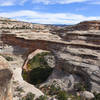
Owachomo Bridge Out and Back
0.5 mi 0.8 km • 172' Up 52.46 m Up • 173' Down 52.61 m Down
Fish and Owl Canyon Loop Route
17.1 mi 27.5 km • 1,992' Up 607.16 m Up • 1,995' Down 608.12 m Down
Blanding, UT
Robertson Pasture Trail (20)
14.5 mi 23.3 km • 2,712' Up 826.49 m Up • 2,711' Down 826.46 m Down
Monticello, UT


0 Comments