
 Continue with onX Maps
 Continue with Facebook


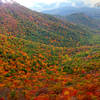
 Particularly Special Place


 Easy
Easy
Easy
Easy
 Easy
Easy
Land Manager: NPS - Shenandoah National Park
 Story of the Forest Trail
1.0 mi 1.5 km • 93' Up 28.21 m Up • 148' Down 45.1 m Down


 Bearfence Loop Trail
1.1 mi 1.8 km • 232' Up 70.77 m Up • 232' Down 70.65 m Down
Stanley, VA
Hawksbill Mountain Loop
2.6 mi 4.2 km • 600' Up 183 m Up • 644' Down 196.36 m Down
Stanley, VA
 Cedar Run Trail
3.0 mi 4.8 km • 2,179' Up 664.07 m Up • 19' Down 5.93 m Down
Stanley, VA
Whiteoak Canyon - Hawksbill Summit Loop
13.6 mi 21.8 km • 3,652' Up 1113.19 m Up • 3,649' Down 1112.08 m Down
Stanley, VA
Whiteoak Canyon to Upper Falls
4.7 mi 7.5 km • 941' Up 286.93 m Up • 942' Down 287.04 m Down
Stanley, VA


 All Clear


0 Comments