
 Continue with onX Maps
 Continue with Facebook


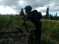
 Particularly Special Place


 Intermediate
Intermediate
Intermediate
 Intermediate
Land Manager: City of Spokane, WA - Parks and Recreation
 Long Loop
10.0 mi 16.1 km • 1,098' Up 334.76 m Up • 1,098' Down 334.79 m Down

 Spokane, WA
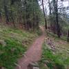
 The Scenic Hills of Riverside
3.3 mi 5.3 km • 251' Up 76.63 m Up • 250' Down 76.28 m Down
Town an…, WA
Dishman Hills Loop
2.6 mi 4.2 km • 335' Up 102.24 m Up • 335' Down 102.1 m Down
 APPLE Sekani Trail Run 10k
6.4 mi 10.3 km • 779' Up 237.4 m Up • 773' Down 235.46 m Down
Millwood, WA
Deep Creek Canyon via Carlton Rd. Trailhead
4.8 mi 7.7 km • 486' Up 148.14 m Up • 486' Down 148.25 m Down
Fairwood, WA
Iller Creek & Rocks Of Sharon Loop
4.8 mi 7.8 km • 1,250' Up 380.89 m Up • 1,243' Down 378.85 m Down
Dishman, WA


0 Comments