
 Continue with onX Maps
 Continue with Facebook


 Particularly Special Place


 Intermediate

 Intermediate
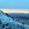
 Naomi Peak - National Recreation Trail
23.6 mi 38.0 km • 6,789' Up 2069.34 m Up • 6,660' Down 2030.02 m Down
Lewiston, UT
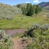
 Spawn Creek Trail Out and Back
12.0 mi 19.3 km • 2,764' Up 842.44 m Up • 2,763' Down 842.21 m Down
 Old Jardine Juniper from Wood Camp
10.2 mi 16.4 km • 2,119' Up 645.75 m Up • 2,118' Down 645.49 m Down
Hyde Park, UT
Card Canyon Loop
7.3 mi 11.7 km • 2,374' Up 723.55 m Up • 2,382' Down 726.06 m Down
North L…, UT
Green Canyon
9.5 mi 15.3 km • 1,124' Up 342.68 m Up • 1,124' Down 342.63 m Down
North L…, UT
 BST: Dry Canyon to Millville Canyon
9.8 mi 15.7 km • 1,064' Up 324.42 m Up • 1,066' Down 324.95 m Down


0 Comments