Dogs No Dogs

Features
Birding · Views · Wildflowers · Wildlife

This is one of the toughest, most strenuous runs in Yellowstone. There's no reliable water anywhere on this 10-mile trail. The only possibility comes from patches of snow, but they often melt by late July. Lightening is a serious concern. The entire trail is highly exposed, with few opportunities to safely run down from the ridge. Exposure to wind, rain and/or cold temperatures also can result in hypothermia. Bring warm clothing, stay dry, and protect yourself from strong winds.
Description
Described here from west to east, the Sky Rim Trail begins at the park’s extreme northwest corner, at a junction with the NFS Trail #100 known as “One Day Ridge,” about a mile west of Yellowstone’s Dailey Pass. The trail ends at the top of Sheep Mountain the highest mountain in this area, about a mile east of the trail’s junction with the
Specimen Creek Trail. Both the beginning and the end of this trail are many miles from a highway.
The first mile to Dailey Pass follows a swath cut through the trees marking the park boundary. Look for interesting YNP boundary markers carved into trees along the way. Dailey Pass is a major 4-way backcountry intersection. A right turn is Yellowstone’s
Dailey Creek Trail, which drops 1600 feet in 5 miles to highway US 191. A left turn is the NFS Dailey Pass Trail NFS #57. The Sky Rim Trail continues straight along the ridge and climbs 600 feet and takes a right turn at a junction with the Tom Minor Divide Trail at 1.7 miles. From there, the views in every direction are spectacular, and they stay that way for miles and miles.
As you head SE along the flower-spangled ridge, look to the horizon on the east for the rounded mountain with the huge metal structure on top – that’s Sheep Mountain, the end of the Sky Rim! Beginning around 2 miles, look for short side trails to the right that lead to nice views and a chance to see fossilized trees (part of the Gallatin Petrified Forest).
The trail rolls up and down (mostly up) and has three big hills to climb (beginning at 2.9, 4.3, & 5.8 miles) on the way to Big Horn Peak. Just after the second climb, the trail levels and disappears into a big meadow. Continue south and watch for trail markers on the far side of the meadow. The trail also is hard to find as you steeply climb the third hill; just keep climbing and you’ll find it.
At 6.4 miles (the top of the third hill), the
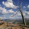
Black Butte Trail junction is passed. The next .3 miles of the Sky Rim to Big Horn Peak (9930') is the real crux of the trail. Here the trail winds through a rocky section with precipitous drop-offs and awesome views. There is no more spectacular scenery anywhere in Yellowstone!
From Big Horn Peak, the trail continues along the ridge dropping 600 feet in the next 3 miles and passing the
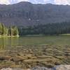
Specimen Creek Trail (just above Shelf Lake). The final mile of the Sky Rim Trail climbs 780 feet along the ridge to the top of Sheep Mountain (10095'). The huge metal communication screen on top is called a “microflector.”
Thanks to guidebook author, Tom Carter, for sharing this trail description. To learn more about visiting Yellowstone, check out his book,
Day
Flora & Fauna
Great chance to see bighorn sheep, especially around well-named Big Horn Peak. Although related to domestic sheep, the bighorn has a coat of hair, not wool. Both the males (rams) and females (ewes) have horns that are never shed. The sheep's age can be learned by counting the growth rings on the horns. Only the ram will develop the full 360-degree curl. Their famous headbutt is the culmination of their struggle for dominance. Biologists believe that very few rams are seriously injured by these impressive battles. However, the horns of big rams often show signs of battle. Although these battles may occur year-round, they play a particularly important role during mating (or rutting) season by assuring that only healthy genes are passed on.
You may also see mountain goats. Though not native to the Greater Yellowstone Ecosystem, these fascinating animals were introduced in southwest Montana in the 1940s and have migrated into the park.
Contacts
Shared By:
Tom Carter

 Continue with onX Maps
 Continue with Facebook


 Particularly Special Place


 Difficult

 Sky Rim - West

 Boiling River Trail
 Bunsen Peak
 Mammoth…, WY
 Emerald and Heather Lakes


0 Comments