
 Continue with onX Maps
 Continue with Facebook


 Particularly Special Place


 Intermediate
Intermediate
Intermediate
 Intermediate
Land Manager: NPS - Sequoia & Kings Canyon National Park
 Mount Whitney via Mount Whitney Trail
20.5 mi 33.0 km • 6,404' Up 1951.98 m Up • 6,405' Down 1952.1 m Down
 Lone Pine, CA
 Golden Trout Creek Loop
25.0 mi 40.3 km • 3,095' Up 943.37 m Up • 3,094' Down 943.2 m Down
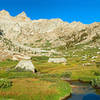
Mineral King Loop
25.6 mi 41.3 km • 9,101' Up 2773.89 m Up • 9,091' Down 2771.03 m Down
 Three R…, CA
 Giant Forest Loop Trail
7.5 mi 12.0 km • 972' Up 296.24 m Up • 952' Down 290.23 m Down
Three R…, CA
 Congress Trail
1.9 mi 3.0 km • 350' Up 106.6 m Up • 314' Down 95.62 m Down
Three R…, CA
Zumwalt Meadows Loop Trail
1.3 mi 2.0 km • 104' Up 31.7 m Up • 123' Down 37.52 m Down
Squaw V…, CA


0 Comments