Dogs Leashed

Features
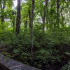
Birding · River/Creek · Views · Wildflowers · Wildlife
Runner Notes
Lots of rocks and roots and some scrambles.
Description
This is the premier trail in the Blue Hills and follows blue trail markers. Between the top of the Great Blue Hill and the Park Headquarters it has two branches. For a description of the south branch look at the
Skyline Trail South Branch.
The trail starts near the intersection of I95/93. From here its flatter and easier terrain, crossing Green St. Then it goes uphill to the summit of Little Blue Hill and has some roots on the trail. It continues downhill to a Park and Ride. Here you cross Rt138 which has a lot of traffic. Afterwards, the trail gets steep with stone steps, slabs and scrambles. Higher up there are many viewpoints. At the top, it gets flat and you pass a weather observatory and observation tower. It becomes a steep downhill from here with slabs, rocks and stone steps. It crosses another trail and quickly goes up Wolcott Hill, a scramble. The trail continues up and down Hermenway Hill and Hancock Hill, with a few more scrambles and some short flatter sections with viewpoints. The last part down to the park headquarters is steep with slabs and roots.
After this, cross Hillside St, and follow a carriage road for a short section and quickly turn into the woods. The trail will get steeper uphill to the top of Tucker Hill, with roots and rocks. On the way to the summit of Buck Hill, you'll pass North Boyce Hill and some ups and downs. Buck Hill has an open summit with nice views. The trail will go steeply down with stone steps and roots to Rt28. You cross the busy road and the trail becomes flat and gentle for a while. You'll reach a carriage road but quickly turn left uphill towards Chicktawbut Hill. The sections here are steep with rock scrambling with nice views.
You'll follow a fence for a while and then go up and down smaller hills like Fenna and Nahanton Hill. You'll then cross a big boulder and continue up and down until you reach the less busy Chicktawbut Rd. There are viewpoints and smaller scrambles along the way. The trail gets steeper up Wampatuck Hill and then down again towards Rattlesnake Hill. Here it passes by the left edge of a rock climbing area, scrambling up to the top. There are nice views here.
From this point, its down and up and you'll pass a water hole with steep cliffs. The trail will be easier here with some roots and cross Wampatuck Rd, another easier crossing. From here, the trail is easier and crosses between two ponds to finally reach the Shea Ice Rink parking lot.
Contacts
Shared By:
Ron Birk

 Continue with onX Maps
 Continue with Facebook


 Particularly Special Place


 Difficult

 4.4 (11)


0 Comments