
 Continue with onX Maps
 Continue with Facebook


 Particularly Special Place


 Difficult
Difficult
Difficult
 Difficult
Land Manager: USFS - Coconino National Forest Office
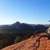
 North Wilson Trail to Sedona Viewpoint
7.2 mi 11.6 km • 2,277' Up 694.02 m Up • 2,277' Down 693.97 m Down

 Sedona, AZ
 Hangover Trail
9.7 mi 15.7 km • 1,058' Up 322.61 m Up • 1,057' Down 322.25 m Down
Sedona, AZ
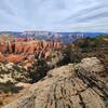
 Soldier Pass Cave and Brins Mesa Loop
5.7 mi 9.2 km • 853' Up 259.97 m Up • 853' Down 259.9 m Down
Sedona, AZ
Long Canyon Out and Back
7.5 mi 12.0 km • 785' Up 239.17 m Up • 784' Down 238.96 m Down
Chimney Rock Loop
2.1 mi 3.4 km • 420' Up 127.99 m Up • 421' Down 128.31 m Down
West Se…, AZ
Bear Mountain Trail
4.6 mi 7.4 km • 1,932' Up 588.9 m Up • 1,932' Down 588.9 m Down
West Se…, AZ


0 Comments