
 Continue with onX Maps
 Continue with Facebook


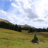
 Particularly Special Place


 Easy/Intermediate


 Easy/Intermediate
Land Manager: Colorado Parks and Wildlife
 Crags Campground to American Lakes
6.5 mi 10.4 km • 1,348' Up 410.76 m Up • 1,347' Down 410.53 m Down
 Lulu City Out-and-Back
3.5 mi 5.7 km • 493' Up 150.25 m Up • 257' Down 78.22 m Down
Timber Lake Trail
9.5 mi 15.3 km • 1,972' Up 601.09 m Up • 1,972' Down 600.95 m Down
Grand Lake, CO
 Mummy Kill Route (Mummy Marathon)
17.4 mi 28.0 km • 4,920' Up 1499.48 m Up • 7,488' Down 2282.32 m Down
Estes Park, CO
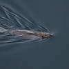
 Beaver Boardwalk
0.1 mi 0.2 km • 3' Up 1 m Up • 3' Down 0.98 m Down
Cascade Falls and Big Pool
7.5 mi 12.0 km • 559' Up 170.27 m Up • 559' Down 170.3 m Down
Grand Lake, CO


0 Comments