
 Continue with onX Maps
 Continue with Facebook


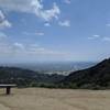
 Particularly Special Place


 Intermediate

 Intermediate
Land Manager: Eaton Canyon Natural Area Park and Nature Center
 Angeles National Forest 50K
32.0 mi 51.5 km • 7,172' Up 2185.89 m Up • 7,172' Down 2186.15 m Down
Sierra…, CA
Arroyo Seco
8.3 mi 13.3 km • 541' Up 165.01 m Up • 542' Down 165.17 m Down
 La Caña…, CA
El Prieto to Brown Mountain Loop
La Caña…, CA
El Prieto to Brown Mountain Loop
8.2 mi 13.2 km • 1,254' Up 382.3 m Up • 1,254' Down 382.32 m Down
 Mt. Zion Loop
9.3 mi 14.9 km • 2,232' Up 680.18 m Up • 2,189' Down 667.06 m Down
Sierra…, CA
Sturtevant Falls
3.4 mi 5.4 km • 639' Up 194.74 m Up • 639' Down 194.85 m Down
Arcadia, CA
 Mt. Bliss from Monrovia Canyon Park
13.5 mi 21.8 km • 2,804' Up 854.79 m Up • 2,803' Down 854.39 m Down


 All Clear


0 Comments