
 Continue with onX Maps
 Continue with Facebook


 Particularly Special Place


 Intermediate/Difficult
Intermediate/Difficult
Intermediate/Difficult
 Intermediate/Difficult
Land Manager: USFS - Eldorado National Forest Office
 Ralston Peak
5.7 mi 9.1 km • 2,560' Up 780.34 m Up • 2,560' Down 780.18 m Down

 South L…, CA
 Echo Lakes to Lake Aloha
12.8 mi 20.7 km • 1,434' Up 437.09 m Up • 1,436' Down 437.71 m Down
South L…, CA
 Wrights Lake to Grouse Lake
4.5 mi 7.2 km • 1,212' Up 369.32 m Up • 1,212' Down 369.37 m Down
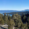
Eagle Vista Loop
0.5 mi 0.8 km • 135' Up 41.21 m Up • 135' Down 41.07 m Down
South L…, CA
Maggie's Peak
4.0 mi 6.4 km • 1,657' Up 505.05 m Up • 1,656' Down 504.66 m Down
South L…, CA
Round Top Loop
6.9 mi 11.2 km • 2,162' Up 658.89 m Up • 2,162' Down 658.97 m Down
South L…, CA


0 Comments