Dogs No Dogs


Government Canyon State Natural Area is open Friday through Monday, 7 am to 10 pm. Some additional openings are found around major holidays, and there may be closures after inclement weather to protect the trails. Check their website for updates,
tpwd.texas.gov/state-parks/….
Admission for visitors 13 years and older is $6. Overnight camping is available.
Pets are allowed on the frontcountry trails only (
Savannah Loop and
Lytle's Loop).
Runner Notes
Trail in Government Canyon SNA are typical of those found in the Hill Country, meaning that rocky conditions are common and trail shoes are recommended. This can considerably slow many runners' "normal" pace, so plan for a longer time on the trail than the mileage may suggest.
San Antonio experiences hot, humid summers and mild winters. The months of June to September often experience highs in the triple digits. Plan around the hottest parts of the day and bring plenty of water, as none is available away from the trailheads. Also be sure to pack out any waste produced during a visit; the SNA overlays the Edwards Aquifer and all runoff will eventually end up in the city's water supply.
Cougars, bobcats and rattlesnakes are part of the wildlife. Cougar sightings are uncommon but a potential danger; they are most active at dusk and sunrise. If out on the trail at these times, avoid running alone, and keep children and pets close at hand.
Description
Caroline's Loop turns off from
Joe Johnston Route about two and one-third miles into the latter, a short distance after
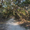
Twin Oaks Trail. A wide singletrack, the Loop has a similar personality to Joe Johnston with a great abundance of rocks. They generally trend smaller in size, but there are also many trickier sections requiring some slab hopping.
The turnoff for the scenic
Overlook Trail is only a few hundred feet into the Loop, with a lone marker showing the way. A clearing afterward features some nice cacti patches. The Loop then begins a half mile climb to its plateau. Long and steady, the climb isn't a difficult incline but is made tougher by the need to find a good line through the rocks. Planning a route through here is a rewarding challenge.
The trail tops out about a mile in and enters a shady area, a welcome relief. After a half mile the Loop begins its descent, similar to the climb but much easier moving downhill.
The final half mile of Caroline's Loop is smooth and flat, broken up by a section merged into a sandy creek bed. The trail ends a short distance from the end point of
Joe Johnston Route. Markers and a rock-ringed stump show the intersection.
Flora & Fauna
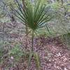
The Texas Hill Country is well known for its abundant tree life. Government Canyon exhibits a number of these varieties, including mountain laurel, Ashe juniper, mesquite and live oak. Birds and deer are the most common animals encountered in the area.
Contacts
Shared By:
Brendan Ross

 Continue with onX Maps
 Continue with Facebook


 Particularly Special Place


 Intermediate/Difficult


0 Comments