
 Continue with onX Maps
 Continue with Facebook


 Particularly Special Place


 Difficult

 Difficult
Land Manager: Ohio State Parks
 Logan Trail North Loop
9.8 mi 15.7 km • 1,476' Up 449.91 m Up • 1,490' Down 454.19 m Down
 Kingston, OH
 Tar Hollow South Loop
12.0 mi 19.3 km • 1,528' Up 465.73 m Up • 1,525' Down 464.84 m Down
 A.W. Marion State Park Loop
5.2 mi 8.3 km • 370' Up 112.72 m Up • 363' Down 110.76 m Down
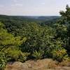
Christmas Rocks State Nature Preserve
4.7 mi 7.5 km • 665' Up 202.76 m Up • 665' Down 202.78 m Down


1 Comment