Trail Run Project Logo

A smooth passage through history beside the Frankstown Branch of the Juniata River on an even-surfaced rail trail.


Your Rating: Rating Rating Rating Rating Rating      Clear Rating
Your Difficulty:
Your Favorites: Add To-Do · Your List
Zoom in to see details
Map Key

11.8

Miles

19.0

KM

100%

Runnable

867' 264 m

High

719' 219 m

Low

169' 51 m

Up

267' 81 m

Down

1%

Avg Grade (0°)

3%

Max Grade (2°)

Dogs Leashed

Features Fall Colors · River/Creek

Section Of

Runner Notes

All hard surface (mostly stone dust, a bit of asphalt at south end).

Description

Section 6 follows the original portion of Lower Trail rail-trail. The trail's name rhymes with "flower" and honors the memory of the wife and son of the late trail benefactor, T. Dean Lower. The trail has a rolled crushed limestone surface except for the beginning of MST's portion, a 2 mile asphalt section through the Borough of Williamsburg that runs northeastward.

South to north is a gentle descent. The Mt. Etna furnace near the middle of the section offers historic displays, and can be a fun place to pause on your run. Water Street near the north end was named for the way Native Americans and early settlers passed the gap in Tussey Mountain - by walking in the river. Two centuries of blasting opened the trail parallel to US 22.

When traveling along the trail, either by foot or bike, you can see many remnants of the canal era, including remains of locks and foundations of lock tenders' houses, as well as the historical Mt. Etna iron plantation area. There are a number of bridge crossings of the Juniata River and one covered bridge over the trace of a historic mill stream. Remains of tipples and massive concrete rock crushers from abandoned stone quarries along the trail hint of the once industrial nature of the now-unbroken forest beside the river.

Alfarata Station parking lot marks the north end of Section 6. The roadwalk along Alexandria Rd was eliminated, see the MST Guide for the most up to date information.

Flora & Fauna

The trail supports many different plant and animal species and the Audubon Society has identified portions of the Lower Trail as “Important Birding Areas.” A number of Bald Eagles and Osprey have been spotted along the trail. There are also many beautiful and some rare plant species along the trail. The Lower Trail is part of the Mid State Trail and the Pittsburgh-to-Harrisburg Main Line Canal Greenway and has been designated a National Recreation Trail by the National Park Service. It is a beautiful, very family-friendly rural trail through wooded areas with few road crossings and provides access to the adjacent Juniata River Water Trail.

Shared By:

Peter Fleszar

Trail Ratings

  4.0 from 1 vote

#1

in Williamsburg

#16263

Overall
  4.0 from 1 vote
5 Star
0%
4 Star
100%
3 Star
0%
2 Star
0%
1 Star
0%
Trail Rankings

#1

in Williamsburg

#345

in Pennsylvania

#16,263

Overall
5 Views Last Month
540 Since Oct 29, 2015
Easy/Intermediate Easy/Intermediate

50%
0%
50%
0%
0%
0%

Photos

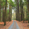
The Mid State Trail while following the Lower Trail
May 20, 2019 near William…, PA
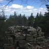
View of the Frankstown Branch of the Juniata River
May 20, 2019 near William…, PA

0 Comments

Weather


Current Trail Conditions

Unknown
Add Your Check-In

Check-Ins

none
Welcome

Join the Community

Create your FREE account today!
Already have an account? Login to close this notice.

Get Started