
 Continue with onX Maps
 Continue with Facebook


 Particularly Special Place


 Easy
Easy
Easy
Easy
 Easy
Easy
Land Manager: NPS - Glacier National Park
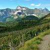
 Siyeh Pass Route
10.2 mi 16.5 km • 2,229' Up 679.35 m Up • 3,371' Down 1027.38 m Down
 Swiftcu…, MT
Reynolds Mountain Out-and-Back
Swiftcu…, MT
Reynolds Mountain Out-and-Back
5.3 mi 8.6 km • 1,306' Up 398.03 m Up • 1,303' Down 397.3 m Down
Red Roc…, MT
 Avalanche Lake via Trail of the Cedars
6.2 mi 9.9 km • 616' Up 187.82 m Up • 616' Down 187.75 m Down
 Red Roc…, MT
 Carthew - Alderson Traverse
12.0 mi 19.3 km • 2,247' Up 685.03 m Up • 3,392' Down 1033.98 m Down
Pincher…, AB
Mount Brown Lookout
10.3 mi 16.6 km • 4,203' Up 1281.08 m Up • 4,203' Down 1281 m Down
Red Roc…, MT
Boulder Pass Loop
35.5 mi 57.1 km • 4,342' Up 1323.4 m Up • 4,365' Down 1330.32 m Down
Trailcreek, MT


0 Comments