
 Continue with onX Maps
 Continue with Facebook


 Particularly Special Place


 Intermediate
Intermediate
Intermediate
 Intermediate
Land Manager: USFS - Uinta, Wasatch & Cache National Forests Office
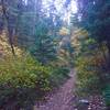
 Desolation Trail to Salt Lake Overlook
4.4 mi 7.0 km • 1,232' Up 375.55 m Up • 1,231' Down 375.32 m Down

 Mount O…, UT
 Lake Blanche Trail
7.0 mi 11.3 km • 2,592' Up 790.06 m Up • 2,592' Down 790.15 m Down
Cottonw…, UT
Lamb's Canyon Pass
4.1 mi 6.6 km • 1,495' Up 455.53 m Up • 1,494' Down 455.42 m Down
Deso-Crest-Dog Loop
12.9 mi 20.8 km • 2,770' Up 844.37 m Up • 2,769' Down 843.89 m Down
Alta, UT
The Living Room
2.4 mi 3.8 km • 960' Up 292.53 m Up • 959' Down 292.33 m Down
Alta-Brighton Loop
8.6 mi 13.8 km • 2,297' Up 700.24 m Up • 2,319' Down 706.93 m Down
Alta, UT


 All Clear


0 Comments