
 Continue with onX Maps
 Continue with Facebook


 Particularly Special Place


 Intermediate
Intermediate
Intermediate
 Intermediate
Local Club: Washington Trails Association
Apr 22, 2024: Pacific Rim Institute
Apr 21, 2024: olt-workshops
Apr 18, 2024: New trail opens in Sammamish, connecting local parks system
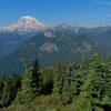
Land Manager: National Park Service - Mount Rainier National Park
 Shriner Peak
7.9 mi 12.8 km • 3,258' Up 993 m Up • 3,258' Down 992.94 m Down

 Eatonville, WA
 Pinnacle Peak
3.3 mi 5.3 km • 1,568' Up 477.88 m Up • 1,567' Down 477.69 m Down
Eatonville, WA
 Alta Vista
1.6 mi 2.6 km • 533' Up 162.58 m Up • 533' Down 162.5 m Down
Owyhigh Lakes
6.9 mi 11.0 km • 1,548' Up 471.93 m Up • 1,548' Down 471.84 m Down
Wonderland Trail
83.8 mi 134.9 km • 23,428' Up 7141 m Up • 23,448' Down 7146.9 m Down
Eatonville, WA
Packwood Lake
8.5 mi 13.7 km • 681' Up 207.53 m Up • 680' Down 207.36 m Down
Morton, WA


0 Comments